Ceduna to Kingoonya
17 – 18 July
Goog’s track was built in the 1970’s by John (Goog) and Jenny Denton with Jenny’s Brother Dennis and various Family and Friends during the winter months over three years. The family lived on the southern border of the Yumbarra Conservation Park, and from what I can work out built the road to more or less see what was out there.
It heads due north from Ceduna to the Transcontinental railway over roughly 160km of sand dunes, 300 of them in total, some of them measuring 25 meters high.
We left Ceduna on the morning of the 17th after filling up our thirsty beast and headed north on National Highway 1. It wasn’t long until we met the gravel road which would take us to the start of Googs track through local wheat country. I should probably add that it was raining and had been on and off all night and through the morning, so the roads were wet, but the puddles weren’t too big. That is until we came to the gate at the start of the track, which was surrounded in a puddle which looked like it could swallow ten of our troopys. Fortunately we spied a side route through another gate which skirted us around the Atlantic Ocean. A few k’s up the now single track we met the dog fence.
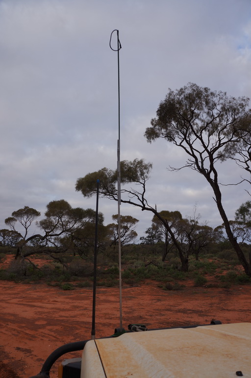
This is where, at the visitor’s centre, they advise you should drop your tyre pressures and install your sand flag (if you have one). Being responsible track users, this is exactly what we did. The ‘sand flag’ however was a piece of 12mm aluminium rod, duct taped to a couple of green garden stakes, topped with an orange propeller flag for marking where your prop is when towing a boat. $9.50 all up. Who says you need to shell out $120 for a commercially made one!


The UHF radio frequency for the track is channel 18, we gave a callout as we started down the track but received silence in return, no-one in our immediate vicinity at the moment at least, will check back later.
The track starts off with a run of small sand hills which gradually get bigger, so it makes adjusting to the sand driving really easy and comfortable. Being almost 50 years old, the sand has compacted very well and is pretty hard, although still gets a bit cut up with people not using low enough tyre pressures. We found that corrugations were a bit of an issue, with the valleys between the sand hills being very corrugated at times, so much so we heard new types of rattles from our vehicle. The drive up the hills is a little soft and bumpy, and the top smooth and soft. Down the north side is usually very smooth and easy going, by far the most comfortable part. This is probably helped by most of the traffic going in the south to north direction as preferred by the authorities for safety reasons.
About 10km down the track, (yip only ten) our DIY sand flag has an incident, and some on the fly repairs are made. Turns out the garden stakes are very thin steel tubes covered in very thin plastic, not quite as bendy and robust as I had hoped. The top of the flag had caught an overhanging tree and bent the lower section. The flag is now 150mm shorter. Oh well, we continue.
At about the 33km mark there is a side track off to some rock pools. These are depressions in the underlying granite rock which is at the surface. These catch the rain water and were a valuable source of fresh water for the Aboriginal people. As it had been raining, the pools were full for us.
Our next stop along the track was the momorials for Goog and his son, ‘Dinger’. Simple rock cairns with a plaque on top. As a sign of remembrance from the travellers, people have left coins on the memorials. This is at the turn off to Lake Goog, a reasonably large salt lake in the middle of the dunes which was discovered by the guys building the road. After rain, the lake does fill with some water, giving it quite an interesting appearance, different to just a large flat salt pan, with a streaky appearance contrasting between areas with and without water.
To their credit, Parks and Wildlife SA were doing improvements to the camp grounds and other facilities in the area. A group of guys were building a toilet facility at the main campground when we arrived and gave us a happy wave. I think we may be the only travellers on the track today, unsurprisingly. We worked out that they must be getting ahead of the curve, with the popularity of Googs track rising and they are making sure the facilities and camp grounds are up to scratch. They are marking the camp sites well, and trying to reduce the amount of 4WDs driving off-track and destroying the hills around the lake. In addition to this they are also trying to stop people driving on the lake. Personally I think this is a great idea as the tyre tracks on the lake definitely detract from the beauty of the surroundings. A little bit around the lake from the first and second camp sites is a high lookout over the lake giving sweeping views of the lake, island and surrounding sand hills.


We set up camp at Tresdia camp overlooking the lake, one of the nicer camp sites we found on our drive around the lake and settled in for roast lamb, vegies and mulled wine for dinner.
Day two started by checking out the brand new toilets at the main lake goog campground. I must say, they are the nicest camp toilets I’ve been in. They declare that they are a hybrid toilet: ‘today’s technology, protecting tomorrow’s environment’ and ‘If you haven’t eaten it, don’t put it in’. It was then back up to the memorials to re-join the main track north. Again this morning we put the call out on channel 18 to see if there were any other travellers in the area, but received only static in return. Another quiet day on the track it seems.
From the memorials, the dunes start getting a bit bigger and a little bit more difficult to drive, but taking it slow, not too much of a challenge. The corrugations between the dunes are not as bad on this section of the track as the surface between the dunes is softer and moves around a bit more. We also noticed that there were fewer puddles on the track even though it had rained overnight and constantly since 6am and it was now about 11am. The biggest difference in the road surface however is the south sides of all of the dunes are quite cut up, (long corrugations with a pitch of about one wheelbase length) making it somewhat difficult to climb the steeper sections of the hills. This is presumably created by some cars spinning their wheels, and then exacerbated by the suspension of following travellers bouncing over them. A fact of these types of tracks I suppose, and not terribly difficult to handle by going slow and trying to enjoy the entire car bouncing up and down 40cm.
We have heard that the largest of the sand hills are about 25m high. In practice we really didn’t notice the high ones as they all seemed to just merge into one hilly mess, and do not present as discrete sand dunes. The tops of most of the dunes are reasonably rounded, making them easy to go over the top of, however there are a few wind swept peaks with a steep drop-off over the other side which makes you question if there is going to be a track on the other side. In a few occasions the track turns right after a blind crest which makes things a bit more interesting.
The flag saga continues… In the morning an upgrade was conducted where a 6mm steel rod is inserted through the garden stake to give it a bit more resilience. This proved to work a treat as it was now able to withstand the overhanging branches coming at us. For the first 20km or so, I would periodically ask Estelle if the flag was ok, and would get a reassuring yes in return, until I ask for about the 6th time, and receive a “No!”. The pole looked ok to me, what could be wrong? Turns out the flag wasn’t sewn as professionally as one would hope, it had been torn cleanly off the piece of elastic it was attached to. How sad. Now our flag was just a sad loop of elastic on the end of a steel rod. Oh well, better than nothing I suppose.
About 45km north of the memorials you get your first view of Mt Finke from the top of a sand dune, which for us was half shrouded in cloud, making it kinda ominous on the horizon poking above the scrub covered dunes. Another hour or so bouncing up and down and we arrived at the turnoff to Mt Finke which is down a 7km track. There are two camp sites at Mt Finke, the first is about 6.5km down the track and is quite large, and the second is about 400m past the carpark at the end of the track from the north-east corner of the carpark. The second campsite is smaller and closer to the mountain.
That night it rained again on and off, most notably when we were trying to start our fire. We were going to have steak that night over the fire, but cancelled on that, reheated some chicken curry, and just used the fire for warmth in between the showers. It was cold that night.
From the carpark at the end of the track you can climb Mt Finke, which takes about an hour and a half return. The track leaves from the south west corner of the carpark behind the picnic table, but don’t get too attached to the track as it seems to disappear about a quarter of the way up, reappearing sporadically, but for the most part it is just a scramble up the large quartzite scree which seems to make up the mountain. From the top you can see quite far into the distance over the scrub and dunes, which don’t appear particularly well defined. To the east are some salt lakes and directly to the west is another mountain which is slightly higher than Mt Finke, so gets the trig station.
Back down in the carpark the 4WD track which leaves from the south west corner circumnavigates the mountain, from reports it is quite a rough track, though we didn’t take it. The track to the north east is an alternate route back to the main track, turning right after the second camp ground. This track ends up winding back directly into the salt lakes. The track goes right through the middle on one of them as marked by steaks across the salt pan. The surface of the lake was very hard, even with the significant rain in the preceding 24 hours. At the salt lakes there was an excellent view back to Mt Finke.


From here back on the main track it winds its way through lower dunes which were very soft when we went through. Heavy corrugations were also present on the flatter sections again. After leaving the regional reserve the track gets a bit rocky as it passes through a station for about 20km until rounding a corner you are presented with the Trans Australia Rail Line. Remembering to stop and look both ways we crossed it and had hotdogs for lunch, reflecting on what an excellent track this was, and being a little sad it is over.
200m up the road from the rail line you meet the dog fence and are supposed to turn right, as it is a private road to the left after about 20km, meaning it doesn’t really go anywhere. The downside of Googs track is that it more or less dumps you in the middle of nowhere, being 400km from Port Augusta and Cooper Peedy via the Stuart Highway, or about the same back to Ceduna via other dirt tracks through the local stations. It was back to Ceduna for us so that we can then go on to the Nullabour.
M
Great Website. Great experiences. You are having and are going to have plenty more wonderful times. We feel as if we are going through the draft of a future book. It comes across beautifully on the iPad that you and Anne gave me. We are reading it all as it arrives, and again later.
Cool blog, I’m enjoying it!
Keep it up!
Cheers Will, We’ll pop past when we’re in your part of the world.